Salt Lake City, particularly the Point of the Mountain, is renowned for its exceptional paragliding conditions, making it a prime destination for enthusiasts of the sport. Here's a detailed overview of what you can expect when flying in Salt Lake City, specifically at the Point of the Mountain:
The Point of the Mountain is celebrated for its smooth air and consistent ridge soaring conditions, attracting pilots globally. The site features two sides: the south side, favored for morning flights due to the smooth, south wind funneling from the Provo valley to the Salt Lake valley, and the north side, ideal for evening flights with similar conditions but from the north. The south side is particularly noted for its 300-foot ridge extending half a mile, allowing for easy top landings close to where you park. The north side offers a 1000-foot ridge behind the launch, providing a mix of light thermal lift and perfect ridge lift .
The Point of the Mountain is conveniently located 20 minutes from downtown Salt Lake, enhancing its appeal with easy access. The site is not only a hub for training but also a social gathering point for pilots, fostering a strong sense of community. Many pilots choose to camp at the site, taking full advantage of the flying opportunities from dawn till dusk .
While the Point of the Mountain is known for its favorable conditions throughout the year, winter flying is also possible, especially on the south side. The area offers opportunities for sled rides or ridge soaring, depending on the weather. The local flying community remains active year-round, with groups and resources available to connect visiting pilots with locals for guidance and company during flights .
Salt Lake City's Point of the Mountain stands out as a premier flying site in the United States due to its unique geographical features that create ideal conditions for ridge soaring and thermal flying. Its accessibility, coupled with a vibrant flying community, makes it a must-visit location for paragliding enthusiasts seeking consistent and enjoyable flying experiences.
Closest partner

Ouest Parapente
Where Paragliding | Salt Lake City | Spots map
The best spots of Paragliding | Salt Lake City
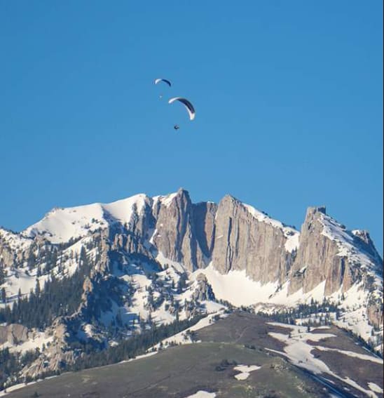
Jupiter Peak, UT
best Conditions
WSW
SW
SSW
S
SSE
SE
Jupiter, Park City Mountain Resort, Utah, USA
Jupiter is a well-regarded paragliding site known for its excellent cross-country (XC) potential. Pilots can launch as early as 8:30 AM and, on a good day, reach altitudes up to 16,500 feet. From there, you can enjoy a scenic tour of the Wasatch Front-Mountain Range, fly east to the Uinta Mountains, or head towards the flatlands into Wyoming.
The site offers various takeoff options and is regularly used by local and visiting pilots. However, it is currently endangered, so it's essential to check with locals and support efforts to preserve it: https://www.ushpa.org/page/help-save-jupiter.aspx.
Winds:
- Maximum recommended wind on launch: 10 mph
- Safe wind directions: 140-230 degrees
Known Hazards:
- Strong cycles at times
- Prone to rapid over-development
- Best flown in late morning to very early afternoon; later in the day, conditions can become gusty and potentially blown out
- Light prevailing south wind is preferred; be cautious of wind switching to the north as the day progresses
- Midday summer conditions can be extremely challenging
Site Sensitivities:
- The launch is very close to Park City Resort’s property; please be respectful of this
- No designated landing zones; landowners do not allow landing at specific zones
- Watch for power lines and rocky, sloped terrain when landing
- Do not fold up your gear on the landing zone; walk to the parking area to pack up
For more detailed site safety plans, visit: http://uhgpga.org/site-safety-plans/#Jupiter
Additional information can be found here: https://www.wilderadventures.com/launch/864/jupiter-park-city
Note: The North American foot launch record from this site is 178 miles.
Popularity: 34 Views
Map & Detailed Forecast
Suncrest, UT
best Conditions
N
NNW
NNE
At an elevation of 1896 meters with a height difference of approximately 230 meters, this paragliding site is occasionally used and typically offers short flights. Pilots often attempt to reach the Point of the Mountain North from this location. However, detailed information about this site is limited.
Popularity: 33 Views
Map & Detailed Forecast
The "B" , UT
best Conditions
WNW
W
WSW
Elevation: 1746 meters, Height Difference: 192 meters
This site is regularly used for walk-and-fly activities and offers some potential for thermal soaring and small cross-country flights. However, it is not recommended due to its dangerous conditions and limited rewards.
Region: Utah, USA
Site Record: 19.3 km
If you plan to fly here, it is crucial to get away from the terrain quickly and be prepared to hike back up if you sink out. The launch requires flying close to the terrain, which is not advisable. The landing area is poor, and the site is generally considered dangerous. Despite its easy accessibility, it is known for its risks, and many pilots wait until they are highly experienced before attempting it.
There is a hazardous thermal convergence above and behind the launch area. The convergence between the 7-11 hill and Hounds Tooth is particularly notorious, with many pilots having to deploy their reserves here. The Hounds Tooth thermal is strong but turbulent, and it is advised not to enter it at a low altitude. The 7-11 peak thermal is more reliable, fed by the face of the B hill and the north and west sides, while the Hounds Tooth is fed by the surrounding terrain. The area where these thermals meet is highly turbulent, especially at lower altitudes.
This site is included in guides to raise awareness of its dangers, as it is often used by pilots flying to the Point of the Mountain. When flying here, it is best to stay out front during strong winds or fly only in light conditions.
Takeoff: This is an advanced site due to the lack of landing zones. The takeoff requires a 20-minute hike up a steep but manageable hill with a 3000-foot mountain behind it. Most pilots hike about 100 yards above the 'B' to launch, as higher areas are difficult to find open spaces for takeoff. There is another launch spot 45 minutes higher, but it is challenging to access.
For more detailed information, you can refer to the [Utah Site Guide](http://www.uhgpga.org/wp-content/uploads/2018/05/UtahSiteGuide-2013_Les_Hooper.pdf).
Popularity: 30 Views
Map & Detailed Forecast
The "H" , UT
best Conditions
WNW
W
WSW
SW
SSW
This paragliding site is situated at an elevation of 1665 meters with a height difference of 162 meters. It is primarily a hike-and-fly location, meaning you will need to hike up to the launch point. Occasionally, the site offers soaring conditions, but these are not guaranteed. There are no flight logs available for this site, indicating it is not frequently used by pilots. It is recommended for pilots with a P-3 rating due to the specific conditions and challenges of the site.
For more detailed information, you can refer to the Utah Site Guide: [Utah Site Guide 2013](http://www.uhgpga.org/wp-content/uploads/2018/05/UtahSiteGuide-2013_Les_Hooper.pdf).
Popularity: 30 Views
Map & Detailed Forecast
Stitches, UT
best Conditions
NNW
NW
WNW
W
WSW
This site offers a takeoff altitude ranging from 1940 to 2200 meters, with a height difference of approximately 500 meters. It is occasionally used and provides opportunities for thermalling. Some cross-country flights are possible from this location. There are multiple takeoff options available, making it a versatile spot for paragliders.
Popularity: 28 Views
Map & Detailed Forecast
PC Hill Park City, UT
best Conditions
W
WSW
SW
At an elevation of 2182 meters with a height difference of 135 meters, this site is a hidden gem for hike and fly enthusiasts. Although it is regularly used by locals, it is not frequently logged. The site offers opportunities for both soaring and thermal soaring, making it a versatile spot for different flying conditions. Toplanding is possible, adding an extra layer of convenience for pilots.
For more information, you can connect with the local paragliding community through their club's Facebook page: https://www.facebook.com/ParkCityParagliding/
Popularity: 28 Views
Map & Detailed Forecast
Big Beacon , UT
best Conditions
WNW
W
WSW
SSW
S
SSE
At an elevation of 2168 meters with a height difference of 620 meters, this paragliding site offers a moderate experience. The hike to the launch site takes approximately 1 hour and 30 minutes. The launch area is multi-directional with a couple of spots to choose from. There are landing areas for speed wings at the base of the hill and a park further out, though you should be cautious of obstacles.
A notable landing zone (LZ) is located inside "This is the Place" park. The park owners request a $5 day-use fee for landing there, which is a winter rate extended to paraglider pilots year-round. Contact Matt Peck at 801-455-7702 to give a heads-up if you plan to land there. The LZ is spacious, equivalent to three football fields, and free of nearby power lines or obstacles. If you prefer not to use this LZ, there are several side hill landing options closer to the hill and trail.
Before launching, it's recommended to notify Airmed dispatch 10-15 minutes in advance at 801-581-2500. They appreciate the heads-up and are supportive of paragliders.
For more detailed information, you can refer to the [Utah Site Guide](http://www.uhgpga.org/wp-content/uploads/2018/05/UtahSiteGuide-2013_Les_Hooper.pdf).
Popularity: 26 Views
Map & Detailed Forecast
Eaglewood, UT
best Conditions
N
NNW
NE
NNE
This paragliding site is situated at an elevation of 1848 meters with a height difference of 253 meters. It is rarely used and primarily suitable for ridge soaring when there is a north wind. For more details, you can check out this flight log: [Flight Log](https://www.paraglidingforum.com/leonardo/flight/1717269).
Popularity: 26 Views
Map & Detailed Forecast
Grandeur Peak North launch lower, UT
best Conditions
NW
WNW
W
WSW
SW
Grandeur Peak, located in the USA, offers a variety of paragliding experiences, particularly suited for pilots with different levels of expertise. The site is generally rated as P-3 due to often strong conditions during mid-day and summer. However, P-2 pilots can fly here with an instructor and should avoid strong mid-day conditions.
The main North launch area, situated at approximately 5,950 feet, is the most frequently used launch point. It is suitable for NW to SW winds and features a gentle slope with grassy areas for easy wing layout. An upper North launch, about 300 feet higher along the same ridge, is steeper and requires more care due to rocks but offers a higher chance of climbing out.
The South launch, located on the next ridge to the south, is steeper and more suited for W and SW winds, providing a more direct glide to the landing zone (LZ).
The primary LZ is at Eastwood Elementary School. Pilots must avoid landing here during school hours, which end at 3:20 pm from Monday to Thursday and at noon on Friday. During school hours, advanced pilots can land along the Bonneville Shoreline Trail below the launch and above the school.
The Grandeur Peak Trailhead, located at about 2900 S Wasatch Blvd (4,950 feet elevation), is a common starting point for the hike, offering good parking. The hike to the launch site takes around 40 minutes, depending on how high you go.
Known hazards include quickly changing wind directions on launch, power lines on the ridges below and near the school LZ, and potential rotor if flying behind ridges or too close to gully/canyon areas. Pilots should maintain good ground clearance and stay high when crossing from ridge to ridge. Midday spring and fall can have very active air, requiring strong piloting skills, while midday summer conditions can be extremely challenging.
For more information, you can visit:
- [Grandeur Peak Paragliding](http://uhgpga.org/grandeur/)
- [Wilder Adventures - Grandeur Peak](https://www.wilderadventures.com/launch/783/grandeur-peak-salt-lake-city)
- [Two Can Fly - Flying Sites](https://twocanfly.com/flying-sites/)
Watch videos of flights from Grandeur Peak:
- [YouTube Video 1](https://www.youtube.com/watch?v=-ZRZ5ZTHwG4)
- [YouTube Video 2](https://www.youtube.com/watch?v=ExfVCUfH1s4)
Popularity: 25 Views
Map & Detailed Forecast
Oly Olympus, UT
best Conditions
NNW
NW
WNW
Located at an elevation of 1681 meters with a height difference of 105 meters, this site offers an easy takeoff and good potential for thermal soaring, especially with the right wind direction and strength. The thermals on the ridge can enable excellent thermal soaring to start cross-country flights. However, higher takeoff options are not recommended.
This site is suitable for pilots of any rating, but you must have very good tight landing skills due to the challenging landing zone. Cross-country flights of up to 13 miles to the “Point” are commonly achieved during the summer months.
The region is in the USA, and the site record is an impressive 94.7 km. This is a very advanced mid-day thermal site and a local favorite for late evening flights, often referred to as the 'Milk Run.'
For more detailed information, you can refer to the Utah Site Guide: [Utah Site Guide](http://www.uhgpga.org/wp-content/uploads/2018/05/UtahSiteGuide-2013_Les_Hooper.pdf).
This thermal site allows flights from Mount Olympus to the North Side, Point of the Mountain. Note that the upper launch is off-limits, and only P-4 rated pilots should attempt it due to the very tight and hazardous landing zone, which includes obstructions, slopes, big rocks, trees, power lines, and houses. The launch is just below the wilderness boundary, so launching any higher is not permitted.
Directions to the site: From Wasatch Blvd, head east on Fortuna Dr., then south on Mile High Dr.
For additional flying sites, visit [Two Can Fly](https://twocanfly.com/flying-sites/).
Popularity: 22 Views
Map & Detailed Forecast
Point of the Mountain upper launch, UT
best Conditions
N
NNW
NW
The North Side at the Point of the Mountain is a great location to experience your first thermic activity and get plenty of airtime. With an elevation of 1756 meters and a height difference of 260 meters, this site is occasionally used for soaring and small cross-country flights.
For more information, you can visit: [Two Can Fly - Flying Sites](https://twocanfly.com/flying-sites/)
Popularity: 22 Views
Map & Detailed Forecast
Point of the Mountain main Draper, UT
best Conditions
NNW
NW
WNW
At an elevation of 1564 meters with a height difference of 95 meters, this site offers various takeoff options, making it a popular choice for afternoon flying. The flat slope takeoff is ideal for thermal ridge flying, and while cross-country flights are rare, toplanding is commonly done behind the launch area.
The North Side of the Point of the Mountain is a fantastic spot to experience your first thermic activity and get plenty of airtime. Consistent evening soaring is a highlight here, with the opportunity to bench up and soar the 2-mile-long mountain behind the launch area. This site is part of a state fly park managed by the Utah Hang Gliding and Paragliding Association (UHGPGA), and membership is required to fly here.
Due to its consistent winds, you can fly nearly every evening during the summer months, and some evenings offer an amazing "Glass Off" as the sun sets. The site is frequently used by local schools for training new pilots and offering tandem flights to the public, so it can get quite busy. The hill behind the launch is also a good spot for hiking and flying speed wings or launching paragliders on very light evenings.
The park is divided into designated areas for hang glider and paraglider launches and landings, with signs and diagrams posted near the walkways.
For more information, visit:
- [UHGPGA](http://uhgpga.org)
- [Utah Site Guide](http://www.uhgpga.org/wp-content/uploads/2018/05/UtahSiteGuide-2013_Les_Hooper.pdf)
- [Paraglide Utah](https://paraglideutah.com/sites)
- [Two Can Fly](https://twocanfly.com/flying-sites/)
- [Flight Reports](http://www.paraglidestl.com/flight-reports/siv-clinic-with-jeff-and-clee)
- [Speedflying Wiki](https://speedflying.fandom.com/wiki/Point_of_The_Mountain)
Check out this video for a closer look: [YouTube Video](https://www.youtube.com/watch?v=l8K9Pfkn-MQ)
For more XC information, visit: [Wilder Adventures](https://www.wilderadventures.com/launch/781/point-of-the-draper)
Popularity: 19 Views
Map & Detailed Forecast
Snowbird Ski Resort, UT
best Conditions
N
NNW
NW
WNW
This high-altitude launch site, situated at 3341 meters with an approximate height difference of 850 meters, is rarely used and considered difficult. It offers excellent cross-country potential, but flying here requires permission. Contact local pilots or Cuasa for authorization: [Cuasa](http://www.cuasa.com).
This site is known for its challenging conditions and is suitable only for advanced pilots (P4). It has a history of remarkable flights, including the North American record and Utah's second-longest flight of 154.1 miles by Bill Belcourt in 2001. Climbs can reach up to 18,000 feet on optimal days.
Located at a ski resort 20 minutes southeast of Salt Lake City, access is via a gondola. The takeoff is just off the gondola on a small ridge, which can create tricky wind conditions. The landing is also challenging, with a side hill approach between trees and a stony surface. Overshooting the landing can be dangerous due to a chairlift at the end. An alternative landing spot is the parking lot at coordinates N40.5839/W111.653. There are no other landing possibilities in Little Cottonwood Canyon except at the entrance.
Flying here without permission can jeopardize access to this site. For more detailed information, refer to the [Utah Paragliding and Hang Gliding Handbook](http://www.cuasa.com/Handbook.htm) by Stacy Whitmore.
Popularity: 18 Views
Map & Detailed Forecast
Mount Baldy, UT
best Conditions
N
NNW
WNW
W
WSW
NNE
Mount Baldy, standing at 3377 meters with a height difference of approximately 800 meters, offers some opportunities for hike and fly or tram-assisted flights. While it does provide some cross-country (XC) potential, it is not a highly frequented or popular site. Be cautious not to confuse it with other locations named Mount Baldy, as this one is less significant in the paragliding community.
Popularity: 17 Views
Map & Detailed Forecast
Upper Cherry Canyon, UT
best Conditions
NW
WNW
W
WSW
SW
SSW
The site offers an elevation range between 2275 and 2451 meters, with a height difference of approximately 1000 meters. It is rarely used, making it a quieter option for those looking to avoid crowded skies. The location is suitable for hike and fly activities, providing a good opportunity for those who enjoy combining hiking with paragliding.
Thermalling conditions are available, allowing pilots to gain altitude using rising air currents. Some cross-country (XC) flying is possible, although it may not be the primary attraction of this site. There are many takeoff options, giving pilots flexibility depending on wind conditions and personal preference. Speedflying is also an option here, catering to those who enjoy a faster, more adrenaline-pumping flight experience.
For a visual overview of the site, you can check out these videos:
- [Video 1](https://www.youtube.com/watch?v=nzPIJnq1DEY)
- [Video 2](https://www.youtube.com/watch?v=EMt1C9YOAMw)
Popularity: 17 Views
Map & Detailed Forecast
Flagstaff Ridge , UT
best Conditions
SSE
SE
ESE
This paragliding site is situated at an elevation of 2938 meters with a height difference of approximately 300 meters. It is primarily known for hike and fly activities. There is one flight log available for this location, indicating limited usage for cross-country (XC) flights.
Popularity: 16 Views
Map & Detailed Forecast