Closest partner

Les Passagers du Vent
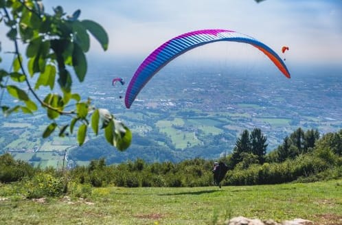
Where Paragliding | Bassano | Spots map
The best spots of Paragliding | Bassano
Bassano Antenne Costalunga
best Conditions
SSE
SE
ESE
E
ENE
Located in Bassano del Grappa - Semonzo, Italy, this paragliding site is highly popular for morning flights and East wind soaring. The takeoff altitude is 740 meters with a height difference of 570 meters, making it an easy launch site. It is frequently used for early takeoffs, which are ideal for cross-country (XC) flights. However, be cautious as the site can become turbulent in the afternoon on normal days.
The main landing area is conveniently located behind Piazza Paradiso, just a 200-meter walk down from Tilly's Locanda in Semonzo. This landing field is situated behind the office of the Club Volo Libero Montegrappa, west of the residential area of Piazza Paradiso di Semonzo. It is exclusively used for paragliding pilots due to its proximity to the mountain base, providing a reliable landing point. To reach it, drive along the main road from Romano d'Ezzelino to Borso del Grappa, turn left onto Via Chiesa, and after about 300 meters, you'll see a piazza and residential complex. Turn left and drive around the back of the complex.
Be mindful of the turbulence caused by the east wind during landing and the houses on the east side of the field. Despite these challenges, the landing area is relatively safe, with good parking facilities and easy access back to the takeoff areas.
For more information, visit [Aero Club Montegrappa](http://www.aeroclubmontegrappa.it/strutture-volo/decollo-antenne).
Coordinates: N45°48.737' E011°44.696'
Altitude: 720m MSL
Elevation: 540m ALZ
Wind: 80°-120°
Suitable for: Paragliding (PG), Hang Gliding (HG)
For flight logs and additional details, check [Flight Log](http://no.flightlog.org/fl.html?l=2&a=22&country_id=105&start_id=525).
Popularity: 70 Views
Map & Detailed Forecast
Col de Draga
best Conditions
S
SSE
SE
ESE
Bassano del Grappa - Semonzo in Italy offers a takeoff altitude of 903 meters. This site is occasionally used for paragliding, and cross-country (XC) flights are possible. The site record for distance is 48.5 km.
Popularity: 70 Views
Map & Detailed Forecast
Chalet Stella Alpina
best Conditions
SSW
S
SSE
Located at an altitude of 715 meters with a height difference of 520 meters, this paragliding site is an easy and frequently used alternative takeoff. It offers good cross-country (XC) potential and is more relaxed compared to Da Bepi, although it is at a lower altitude.
Make sure to follow local rules, especially regarding parking, which is only allowed at the Chalet. Note that the shuttle service does not stop here.
For more information on flights from this location, you can filter flights on xcontest. However, filtering is not possible on Leonardo. The region is Italy, and you can view nearby flights and the flight area record of 195.1 km through the provided link.
The 'Space of Love' (formerly known as Stella Alpina) is nearby, offering a bar, hotel, and a 'Bio' restaurant. The owners of the ground also manage this establishment. More details can be found on their website: [Space of Love](http://www.spaceoflove.it/), located at Via G. Giardino no.3, Borso del Grappa.
This takeoff is thermally active a bit later than others, so record flights are not common from here. It is a more relaxed spot, and you might consider staying at one of the three chalet rooms available.
For additional information on the takeoff structure, visit [Aeroclub Montegrappa](http://www.aeroclubmontegrappa.it/strutture-volo/decollo-stella-alpina).
The takeoff is suitable for paragliding with a south-facing exposure. Parking near the takeoff is strictly prohibited; use the Chalet parking area. Ensure that the wind socks indicate the same direction before taking off, as this site is only suitable with a south wind.
Popularity: 65 Views
Map & Detailed Forecast
Cima Mandria Malga Vedetta Rossagno 2
best Conditions
WSW
SW
SSW
SSE
SE
ESE
Located in the Veneto region of Italy, this paragliding site offers a main takeoff point at an altitude of 1440-1480 meters. The site is regularly used and provides several takeoff options, making it a versatile choice for pilots. Thermal soaring is reliable here, and good cross-country (XC) flights are possible.
The site was established in 2012 by Club Consorzio Valcavasia. For more information, you can contact them at Piazza Pieve/2, 31034 Cavaso del Tomba TV, via email at info@valcavasia.eu, or by phone at +39 377 1263556. Paolo Cattuzzo is a point of contact.
Access to the launch site is straightforward. From Cavaso d.T, head past the piazetta and follow the signs for "Monte Tomba" via Generale Angelica. After several turns, you will reach a plateau. Take a small path on the left, and after 500 meters, you will arrive at the launch area. This description applies to the main takeoff point.
The thermals here are good and reliable, making it a promising area for thermal soaring and XC flights. There is potential for a shuttle service in the future.
For landing, head west of Cavaso. From Via Roma, turn left into Via Strade Nuova. After 1 km, you will find a path on the right-hand side leading to a 150-meter-long landing stretch. The landowner's pub offers refreshments and even a pool for a post-flight dip.
For more detailed information, you can visit [this forum](http://gleitschirmdrachenforum.de/showthread.php?27841-Neues-Fluggebiet-östl-von-Bassano).
The lower launch site is not recommended for beginners due to the need for reverse launching in strong winds and the proximity of a tree group at the end of the 300-meter-long, flat launch area. However, with a quick start and good equipment, you can easily clear this obstacle.
The upper launch sites are generally steeper and shorter.
Popularity: 65 Views
Map & Detailed Forecast
Possagno 1
best Conditions
S
SSE
SE
ESE
The takeoff site at an altitude of 1410 meters in the Veneta region of Italy is occasionally used for paragliding. It offers opportunities for soaring and cross-country (XC) flights, although it is not the most popular takeoff in the area. The site has a recorded flight distance of 58.4 km. Another nearby takeoff is more frequently used by paragliders. The distance to the nearest landing zone is approximately 2.5 km.
Popularity: 64 Views
Map & Detailed Forecast
Monte Colombera
best Conditions
SSW
S
SSE
SE
ESE
This paragliding site, with an altitude ranging from 1350 to 1406 meters and a height difference of 1150 to 1200 meters, is occasionally used for soaring and cross-country flights. There are several takeoff options available, although it is not an official site.
When approaching, if you see a large cross on the right side of the road at a left bend, usually with a black raven perched atop it, you've missed the runway by about 100 meters. The runway is not visible directly from the road as it is on the right, below road level.
For more information, you can visit:
[Skyfly Bassano](http://www.skyfly.cz/zajimavo_e/bassano_e.htm)
[Skyfly Bassano 2](http://www.skyfly.cz/zajimavo_e/bassano2_e.htm)
[Skyfly Monte Colome](http://www.skyfly.cz/tereny/mcolome.htm)
Location: N45°51.274' E011°48.013'
Altitude: 1410 meters MSL
Elevation: 1230 meters ALZ
Wind Direction: 130°-200°
Suitable for: Paragliding (PG), Hang Gliding (HG)
Popularity: 63 Views
Map & Detailed Forecast
Monte Bertiaga
best Conditions
WSW
SW
SSW
S
SSE
SE
This site, with an elevation ranging from 1245 to 1262 meters, is considered easy and is occasionally used by a small number of local pilots. The takeoff area is very flat, which can be a bit challenging for some. While soaring is possible here, cross-country (XC) flights are limited but achievable under the right conditions.
For more details on flights from this location, you can check out this link: [Flight Details](http://www.paraglidingforum.com/leonardo/flight/256304).
Popularity: 63 Views
Map & Detailed Forecast
Bassano Da Beppi Tappeti
best Conditions
WSW
SW
SSW
S
SSE
SE
Monte Grappa, Italy, is a highly frequented paragliding site known for its relaxed soaring and excellent cross-country (XC) potential. The site is accessible all year round, with the best XC conditions typically from March to May, though autumn and winter also offer good thermal soaring opportunities.
Monte Grappa allows for flying nearly 300 days a year due to its favorable geographic location. It is a favorite destination for pilots from all over Europe. Besides paragliding, the area offers various alternative activities such as Nordic walking, climbing, mountain biking, and hiking.
The main takeoff area, known as Col del Pupolo or Decollo Sud, faces south and is suitable for launches with slight southeast or southwest winds. The takeoff area is equipped with carpets and rubber mats, but pilots should still be cautious with their lines. There is also a small grass takeoff area and a hang gliding ramp nearby, so be careful when launching to the left.
The Monte Grappa Air Park provides shuttle services from Semonzo, as parking near the takeoff is limited. Pilots need to bring their license and insurance proof to purchase shuttle tickets at the flight school office.
For weather updates, visit the Aeroclub Montegrappa website: [Aeroclub Montegrappa Weather](http://www.aeroclubmontegrappa.it/index.php?option=com_content&view=article&id=66&Itemid=67).
Accommodation options include the Garden Relais, a campsite near the pizzeria, and various B&Bs. The Garden Relais is also a popular meeting spot for pilots, offering food and drinks.
Directions: If coming from Brenner, take the Trento Nord exit, continue on SS47 towards Padova, exit at Bassano-Centro, turn left at the first intersection towards Romano d'Ezzelino, and then through Semonzo (turn left at the gas station) to reach your destination.
For more information, visit [Aeroclub Monte Grappa](http://www.aeroclubmontegrappa.it/strutture-volo/decollo-tappeti) and [Parapendio Biposto](http://www.parapendiobiposto.it/home/siti-di-volo/veneto/bassano-tv.html).
Popularity: 62 Views
Map & Detailed Forecast
Bielli Marostica
best Conditions
WSW
SW
SSW
SSE
SE
ESE
This paragliding site in Italy offers a takeoff height of 840 meters and a height difference of 780 meters. It is a medium-difficulty site, frequently used by pilots. The site is known for its soaring conditions and offers good potential for cross-country (XC) flights. There are various takeoff options available, making it versatile for different wind conditions.
The site has a recorded flight distance of 29.6 km, showcasing its potential for longer flights.
For more detailed information, you can visit the local paragliding club's website or contact local pilots who frequently fly in this region.
Popularity: 60 Views
Map & Detailed Forecast
Villa Solagna
best Conditions
WSW
SW
SSW
This takeoff point, situated at an elevation of 1011 meters, is rarely used and not officially recognized. There are no flight logs available for this location, making it largely irrelevant for most pilots.
The takeoff area is on a ridge facing west towards Villa Solagna, a few kilometers past Costalunga. It was used by the Oslo Paraglider Club during Easter 2002 when southwest winds caused turbulence at Costalunga. To reach this spot, drive approximately 5-7 kilometers from Costalunga until you see a small house on the right. Above this house, there is a large, steep grassy field facing west into the valley.
This location is not an official takeoff point. There are no suitable landing areas below, so pilots are advised to fly around Costalunga and land at Tilly's. For more information, you can visit [Flightlog](http://www.flightlog.org/fl.html?l=1&a=22&country_id=105&start_id=575).
Popularity: 59 Views
Map & Detailed Forecast
Bassano Da Beppi 2
best Conditions
WSW
SW
SSW
S
SSE
SE
H 841 is the secondary takeoff point. It lacks a carpeted launch area and is frequently closed. For comprehensive details, please refer to the primary takeoff point.
Region: Italy
Nearby flights: [47804]
Flight area record: 195.1 km
For more information, visit [link].
Popularity: 58 Views
Map & Detailed Forecast
-HG Col del Puppolo Pedana
best Conditions
SSE
SE
ESE
This is the main hang glider ramp takeoff on Grappa Mountain, located above Borso del Grappa in Italy. With an altitude of 858 meters and a height difference of 650 meters, this site is frequently used by hang gliders and is not suitable for paragliders. It offers good cross-country flying potential.
The takeoff area, known as "Decollo per deltaplano pedana delta," features a car parking area, a space for assembling hang gliders, a designated area for parking hang gliders, and a bar/trattoria that is open year-round.
For more information, you can visit the Aeroclub Montegrappa website: [Aeroclub Montegrappa](http://www.aeroclubmontegrappa.it/strutture-volo/decollo-bar-deltaplano).
To view a video of the site, check out this YouTube link: [Grappa Mountain Hang Gliding](http://www.youtube.com/watch?v=Cbwqr0W279s).
Popularity: 58 Views
Map & Detailed Forecast
Monte Legnarola
best Conditions
SE
ESE
E
ENE
Monte Legnarola, located at an altitude of 1280 meters, offers a unique paragliding experience in Italy. The site is occasionally used and is suitable for soaring and cross-country (XC) flights. Top landing is possible, although it is not an official site.
The takeoff direction is South/Southeast (S/SO). To reach the takeoff point, follow the road to the Monument, pass Baita Camol, and then take the path marked by the Malga Camol sign. The path is a 10-minute walk.
The site record for the longest flight is 48.8 km.
For more information, you can contact the A.S. Manta flying school at www.mantaonline.it.
Additional resources:
- Monte Grappa Airpark: http://www.montegrappa-airpark.com
- Skyfly: http://www.skyfly.cz/zajimavo_e/bassano_e.htm
- Aero Club Monte Grappa: http://www.aeroclubmontegrappa.it
Popularity: 58 Views
Map & Detailed Forecast
Cima Grappa
best Conditions
WSW
SW
SSW
SSE
SE
ESE
At an altitude of 1560 meters and 1400 meters, this paragliding site is very frequently used and offers excellent soaring conditions. Cross-country (XC) flights are possible, and top landing is also feasible. The best season to fly here is from March to August.
Be cautious, as there are several takeoff points named 'Panettone' in Italy. Make sure not to confuse them. Sometimes, the Monte Grappa shuttle service goes up to this site. If not, you will need to drive up with your own car.
It's crucial to inform yourself about the no-fly zones. Maps indicating these zones can be found where the shuttle buses depart.
This site is located in the Semonzo region of Italy. The site record is 92.8 km. For more information, you can visit [Monte Grappa Air Park](https://www.montegrappa-airpark.com/pages/home/fluggebiet/panettone-en-GB.aspx).
The takeoff area is suitable for both paragliding and hang gliding, facing east-southeast. In laminar wind conditions, it is possible to take off even with wind from the west. The area features a large meadow, making top landing possible even for hang gliders. This site is often used for competitions. Note that in winter, the roads may be closed due to snow.
Bassano del Grappa is a renowned hub for paragliding and hang gliding in the Southern Alps. The area is particularly busy in winter and early spring. The thermals are interesting year-round and can be used for cross-country flights early in the year. Despite the high number of pilots, the flight operations are well-distributed along the slopes. Flying eastward is relatively easy up to the Piave Valley, while flying westward requires crossing the Brenta Valley and then following the ridge.
Flight schools also use Bassano for altitude flight training. Pilots often gather at the Monte Grappa Airpark in Semonzo or at the Garden Relais Hotel. A Flycard is required for takeoff and landing fees. For hang gliders, there is a short, steep ramp available. There are several accommodation options in Semonzo and the surrounding area, with the Garden Relais Hotel being particularly popular due to its proximity to the landing field and training area.
The takeoff is generally straightforward, but many pilots get blown over the falconry area and end up landing there. It's best to review the no-fly zones in advance.
For more details, you can visit [Aero Club Monte Grappa](http://www.aeroclubmontegrappa.it/strutture-volo/decollo-panettone).
Popularity: 58 Views
Map & Detailed Forecast
Monte Caina
best Conditions
SSE
SE
ESE
E
ENE
The takeoff altitude is 982 meters with a height difference of approximately 760 meters. This site is an alternative takeoff location and is very rarely used. It serves as a reference point for cross-country flights. There are various takeoff options available, including some slightly higher spots suitable for south and southwest winds. Toplanding is possible at this site.
For more details on specific flights from this location, you can check the following links:
[Flight 1](http://xc.dhv.de/xc/modules/leonardo/index.php?name=leonardo&op=show_flight&flightID=30244)
[Flight 2](http://xc.dhv.de/xc/modules/leonardo/index.php?name=leonardo&op=show_flight&flightID=133977)
Popularity: 57 Views
Map & Detailed Forecast
Lusiana
best Conditions
W
WSW
SW
SSW
This site, with an elevation of 782 meters, is occasionally used for paragliding. It offers several takeoff options within a few kilometers, suitable for some thermal flying and cross-country (XC) flights. The site record stands at 63.2 km. The region is unspecified but located in Italy.
Popularity: 55 Views
Map & Detailed Forecast
Cavaso del Tomba
best Conditions
S
SSE
SE
ESE
Located at an elevation of 967 meters, this paragliding site in Italy is rarely used. It offers opportunities for soaring and cross-country (XC) flights. The site is also known as an XC reference point. The site record stands at 58.4 km.
Access details are unclear, particularly regarding how far you can drive up with your car. The takeoff area is generally undisturbed and not particularly challenging. Most pilots tend to turn to the right to catch the first thermals.
For more details on specific flights, you can visit: [Flight Record](http://www.dhv-xc.de/leonardo/index.php?op=show_flight&flightID=1446835).
Popularity: 55 Views
Map & Detailed Forecast
Rubbio
best Conditions
WSW
SW
SSW
SSE
SE
ESE
Located in Bassano del Grappa, Italy, this paragliding site offers an elevation of 867 meters with a height difference of 739 meters, making it an easy spot for both beginners and experienced pilots. It is frequently used and known for good cross-country (XC) flying possibilities. There are various takeoff options on both sides of the Antenna, and toplanding is possible.
This is a private flying site, and foreign pilots or schools must obtain written permission to use the takeoff and landing zones. For permissions, contact Fabio Loro at +39-329-2286839 or visit www.mantaonline.it.
The site is popular for its large takeoff area with a SouthEast to SouthWest exposure. It is used by a local school and for competitions, so free flyers should always ask for permission before using the site.
For more information, you can visit the A.S. Manta flying school at http://www.mantaonline.it/corsi_para.htm.
The region has notable flight records, with the site record being 107.0 km.
Popularity: 53 Views
Map & Detailed Forecast
Col Serai Casette
best Conditions
WNW
W
WSW
SW
SSW
At an altitude of 980 meters with a height difference of 780 meters, this medium-difficulty takeoff is frequently used, not because it is an exceptional launch site, but due to its location in Bassano. While good cross-country (XC) flights are possible, they are rare. This site serves as an alternative high takeoff for southwest to west winds. However, with a clear west wind, Bassano is not ideal, especially for low-level soaring.
The Casette takeoff is a large meadow facing west, exclusively used for paragliding. The size of the slope allows for top landings with a certain margin of safety. Refreshments are available during the summer season. It is strictly prohibited to take off from the east side. Vehicles must be parked on the side of the road, and maneuvers within the courtyards of nearby houses are forbidden.
For more details, visit: [Aeroclub Montegrappa - Casette Takeoff](http://www.aeroclubmontegrappa.it/strutture-volo/decollo-casette)
Popularity: 53 Views
Map & Detailed Forecast
Monte Legnarola Baita Camol
best Conditions
WSW
SW
SSW
Located in the Veneto region of Italy, this paragliding site offers an elevation of 1208 meters with a height difference of 1010 meters. It is regularly used for soaring and cross-country (XC) flights, although it is not an official site.
In the Bassano del Grappa area, the site record stands at 51.5 km, while the broader Veneto region has a site record of 49.9 km.
For more information or to arrange flights, you can contact the A.S. Manta flying school at www.mantaonline.it. Additional details can be found at www.skyfly.cz/zajimavo_e/bassano_e.htm and www.aeroclubmontegrappa.it.
Coordinates: N45°50.369' E011°47.175'
Altitude: 1210 meters MSL
Elevation: 1030 meters ALZ
Wind direction: 160°-200°
Suitable for: Paragliding (PG), Hang Gliding (HG)
Popularity: 52 Views
Map & Detailed Forecast
Caltrano Pra del Giglio
best Conditions
SSW
S
SSE
SE
ESE
Located in Caltrano, Italy, this paragliding site offers a takeoff height of 707 meters and a height difference of 459 meters. It is frequently used for thermal soaring and offers good potential for cross-country (XC) flights. The site is known for its various takeoff options between Pra de Giglio and Foroaro, with this particular spot being the most favored despite its relatively low altitude.
The site has recorded flights of up to 48.4 km and 44.7 km, showcasing its potential for longer XC flights. For a panoramic 360° view of the takeoff area, you can visit [this link](http://www.asddeltaclubvicenza.it/images/Decolli%20panoramici/DCV.swf).
Popularity: 51 Views
Map & Detailed Forecast
Colle Campeggia
best Conditions
SSW
S
SSE
SE
ESE
Located in Romano d'Ezzelino, Italy, the Col Campeggia takeoff site is situated at an altitude of 1100 meters above sea level with an elevation of 920 meters above the landing zone. This site is predominantly used for hang gliding competitions due to its favorable conditions and ample space. The takeoff area features a large, flat grass surface, making it possible for toplanding.
The site is frequently used and is known for good cross-country (XC) flying for both hang gliders (HG) and paragliders (PG). However, it is important to note that the site should not be used with westerly winds.
For more information, you can visit the Aeroclub Montegrappa website: [Aeroclub Montegrappa - Col Campeggia](http://www.aeroclubmontegrappa.it/strutture-volo/decollo-col-campeggia).
Coordinates: N45°50.216' E011°44.898'
Wind direction: 150°-190°
This site is rated highly for its frequent use and suitability for competitions.
Popularity: 49 Views
Map & Detailed Forecast
Caltrano Monte Corno 2
best Conditions
SSW
S
SSE
SE
ESE
Located in Italy, this paragliding site offers a takeoff altitude of 1,320 meters above sea level. The height difference is approximately 1,100 meters, making it a medium-difficulty site. The site is occasionally used and is suitable for both soaring and cross-country (XC) flights.
Takeoff is accessible via the local road from Garziere, Piovene Rocchette, Caltrano, Calvene, and the road to Cavalletto, Malga Foraoro (35 km). Windsocks are present to assist with takeoff.
Landing zones are as follows:
- For hang gliders: Garziere, located 8.5 km from the takeoff point and not visible from the takeoff.
- For paragliders: Colombare, at an altitude of 280 meters above sea level. Access is via the road from Piovene Rocchette to Asiago, then from Caltrano to Cogollo del Cengio, and finally asking for directions to Colombare at Mosson. This landing zone is 3.7 km from the takeoff point and is also not easily visible from the takeoff. Windsocks are present here as well.
The Colombare landing zone is managed by the local club. The area is frequented by hang gliders, gliders, and paragliders. Takeoff is best with winds from the South, South-East, or South-West along the road, in a municipal area not managed by the club. Cross-country flights are possible towards M. Summano or Bassano, with a critical point at Valle di Lavarda. Be cautious of turbulence near the rocks in the M. Pau area.
Flight difficulty is rated as medium.
For more details, visit: [Delta Club Vicenza Map](http://www.schio.it/deltaclubvicenza/mappa/dec-Foraoro.htm)
Popularity: 49 Views
Map & Detailed Forecast
Casere
best Conditions
SSW
S
SSE
Located at an altitude of 1259 meters, this paragliding site in Italy is rarely used. It offers opportunities for soaring and mini cross-country flights. The site record stands at 8.9 kilometers.
The region is Casere, Italy. The launch area is situated along the mountain road from Feltre to Panatone, above Lago di Corlo.
For more information, you might want to check local paragliding clubs or forums.
Popularity: 47 Views
Map & Detailed Forecast
Caltrano Monte Corno 1
best Conditions
WSW
SW
SSW
S
SSE
SE
Elevation: 1180 meters, Height Difference: approximately 930-1000 meters.
This site is frequently used for thermal soaring, and occasionally, good cross-country flights are possible. The takeoff area is also utilized for competitions.
Region: Italy
Site record: 44.9 km
For more information, you can visit:
[CP Triveneto - Caltrano Paragliding Competition](http://www.cptriveneto.it/2010/04/gara-caltrano-parapendio-triveneto-articolo-2010/)
[Aeroclub Blue Phoenix](http://www.yumping.it/parapendio/aeroclub-blue-phoenix--e19636892)
Popularity: 39 Views
Map & Detailed Forecast