Find the best sessions nearby in 1 click. Simple, customizable and collaborative
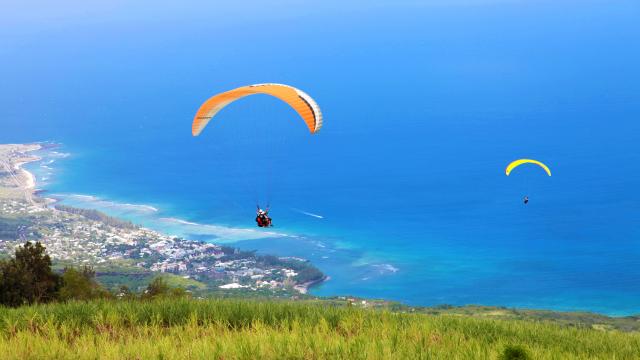
Paragliding Dos D'Ane
best Conditions
Wind Dir. :
WSW SW SSW
Wind: Mini: 0| Maxi 30 kmh Gust Max : 35 kmh
Description
Altitude: 840 meters. Occasionally used, cross-country flights possible. Located in the Reunion region. To reach the take-off point, head to the village of Rivière des Galets, situated opposite the city of Le Port, towards the mountains. From there, ascend to the Dos d'Ane church, which takes about 40 minutes on foot. After passing the church on your left, descend the concrete road and then take the dirt track on the right, approximately 300 meters past the church. A 10-minute walk up this path will bring you to the take-off area. For more information, visit https://www.lvlr.re/sites-parapente-reunion/
Take-off altitude is 900 meters. Access involves going to Rivière des Galets village, then ascending to Dos d'Ane church, which takes about 40 minutes on foot. Don't miss the bakery with a paragliding decoration to try the local specialty, Macatia. After the church, descend the concrete road and then take the dirt track on the right for about 10 minutes. There is also a bus option near the bakery in Rivière des Galets that can take you up to the village of Dos d'Ane. https://www.youtube.com/watch?v=LH24tujD9n8